Are you wondering how to use survey plans as proof of ownership in Nigeria? In fact, can survey plans be used as proof of ownership in Nigeria? We will find out in this article.
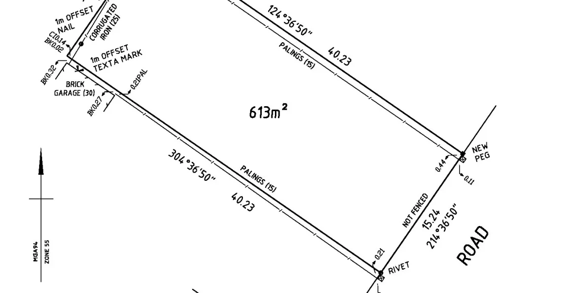
Survey plans which serve as vital tools in demonstrating property ownership in Nigeria also provide a detailed layout of land parcels and establish the exact boundaries, measurements, and landmarks.
Survey plans are legally recognized documents that prove ownership. They are often essential for resolving disputes, obtaining titles, and securing loans.
Understanding how to use survey plans as proof of ownership in Nigeria requires a grasp of their purpose, the legal frameworks, and the steps to obtain and validate a survey plan.
The good news for you today is that we will explain the role of survey plans, their components, the legal backing for their use, and practical steps to ensure they serve as effective proof of ownership.
Key Elements of a Survey Plan
Below are the key elements of a survey plan:
- Plot Coordinates: This defines the exact position of the land within the geographical grid.
- Landmark Descriptions: This identifies physical features around the land that are unique and recognizably permanent.
- Surveyor’s Stamp and Seal: It verifies the authenticity of the document by indicating it was prepared by a registered surveyor.
In Nigeria, land ownership and rights are governed by the Land Use Act of 1978. While the Act provides the framework for land ownership, survey plans are critical to verifying and establishing claims to specific parcels of land.
Also, Nigerian courts recognize survey plans as valid evidence of ownership when they are prepared in accordance with legal guidelines by registered surveyors. Some legal bases for the use of survey plans include:
- Court Recognition: Courts in Nigeria accept survey plans as evidence of ownership in property-related cases, provided they are legally certified.
- Statutory Requirements: Government agencies require survey plans for title registration, land transfer, and property valuation processes.
- Mortgage and Loans: Financial institutions use survey plans to verify ownership and estimate the value of land for securing loans.
Components of a Survey Plan in Nigeria
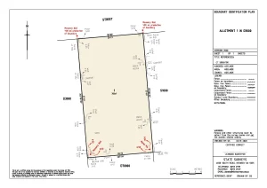
A valid survey plan in Nigeria must contain specific elements. Each component has significance in establishing the land’s identity and ownership. These include:
- Title Block: This contains essential information like the surveyor’s name, the owner’s name, and the surveyor’s registration number.
- Boundary Description: This outlines the coordinates, distances, and angles between each corner of the property.
- Plot Number and Size: This specifies the area of the land in square meters and the registered plot number if applicable.
- Scale of Plan: It indicates the ratio between the size of the drawing and the actual land size.
- Endorsement by a Surveyor: A legally certified surveyor must sign the document, with an official stamp confirming its validity.
Types of Survey Plans in Nigeria
Understanding the types of survey plans can be beneficial, as each type serves a different purpose and holds varying levels of authority as proof of ownership.
- Preliminary Survey Plan: This is often the first step in mapping out land boundaries, this plan is useful for initial documentation but is not typically recognized in legal or property transactions.
- General Boundary Survey Plan: It is used for larger-scale demarcations, often covering multiple parcels or estates. It’s ideal for subdivisions and estate planning.
- Title Survey Plan: This is a legally binding document, certified by a registered surveyor, and essential for registration of land titles.
- Topographical Survey Plan: This includes additional information about the land’s terrain, elevations, and other physical features. It is essential for construction and development projects but may not always serve as primary ownership proof.
READ ALSO:
- Is Proof of Ownership Renewable in Nigeria?
- What is an Affidavit of Proof of Ownership in Nigeria?
- Where Can I Get a Certificate of Ownership in Nigeria?
- Who Issues Proof of Ownership in Nigeria?
- How to Get a Proof of Ownership Certificate
How to Obtain a Survey Plan in Nigeria
The process of obtaining a survey plan is critical to ensuring that it meets legal requirements and can be used as proof of ownership. Here’s a step-by-step guide:
- Hire a Registered Surveyor: Only surveyors registered with the Surveyors Council of Nigeria (SURCON) are authorized to create valid survey plans. Confirm the surveyor’s credentials before engaging their services.
- Site Inspection and Measurement: The surveyor will visit the land to take precise measurements, identify boundaries, and note landmarks.
- Plotting and Documentation: Based on the surveyor’s measurements, a layout of the land will be drawn, showcasing the exact size, location, and boundaries.
- Authentication and Approval: Once completed, the surveyor must endorse the survey plan with their official seal and signature. In some cases, government authentication may be required.
To get your Survey Plan fast and from the comfort of your home CLICK HERE
How to Validate the Authenticity of a Survey Plan
Ensuring the authenticity of a survey plan is essential before relying on it as proof of ownership. Verification processes include:
- Verify the Surveyor’s License: Contact SURCON to confirm the surveyor’s registration status.
- Cross-Check Land Coordinates: Cross-referencing the coordinates on the survey plan with official records helps ensure accuracy.
- Government Endorsement: In some states, survey plans must be authenticated by the state’s Surveyor General’s office, which adds an additional layer of legitimacy.
- Use of GPS Verification: Advanced technology such as GPS coordinates can help in verifying the position and boundaries of the land as outlined in the survey plan.
Survey plans are important in settling boundary or ownership disputes. They are used as documentary evidence to clarify land boundaries and ownership rights. Here’s how a survey plan can be employed in legal contexts:
- Proof of Boundary: During disputes over boundaries, survey plans can provide precise boundary lines to the court.
- Historical Ownership Records: When disputes arise over ownership, survey plans provide a record that often includes the history of the land, previous owners, and transfers.
- Comparison with Other Land Documents: Survey plans can be compared against land titles or deeds, allowing the court to determine rightful ownership.
Role of Survey Plans in Property Transactions
Survey plans are an essential part of property transactions in Nigeria, where they serve as legal proof of the land’s existence, location, and dimensions. Their role includes:
- Verification Before Purchase: Buyers should request a copy of the survey plan to confirm that the land’s boundaries and size match their expectations.
- Land Valuation: For purposes of land valuation, survey plans provide the specifics needed to estimate the market value of the property.
- Title Registration: Government agencies often require survey plans when registering property titles to confirm the land’s location and boundaries.
Challenges in Using Survey Plans as Proof of Ownership in Nigeria
Although survey plans are widely recognized, there are challenges associated with their use, including:
- Forgery and Fraud: Counterfeit survey plans are a growing concern, often used in land scams to deceive buyers.
- Boundary Disputes: In densely populated areas, inaccurate or outdated survey plans can lead to disputes, especially when natural landmarks have shifted or disappeared.
- Inconsistent Regulations: Varying state regulations on survey plan authentication and requirements can create confusion, especially for inter-state land transactions.
To safeguard your survey plan as proof of ownership, consider these tips:
- Store Multiple Copies: Keep both digital and physical copies of the survey plan in secure locations.
- Register the Plan with Authorities: Where possible, ensure the survey plan is recorded with the Surveyor General’s office.
- Regularly Update Survey Plans: For lands in rapidly developing areas, periodic updates to survey plans are essential to reflect changes in boundaries or physical landmarks.
- Seek Legal Counsel: Consult with a property attorney to confirm that the survey plan meets legal standards and can be used in court if necessary.
Survey plans are invaluable documents in establishing property ownership in Nigeria. They offer precise, legal descriptions of land that can be essential in property transactions, boundary clarification, and title registration.
By understanding the components, legal backing, and the necessary steps for obtaining a legitimate survey plan, property owners and buyers can effectively use survey plans to secure and assert ownership rights in Nigeria.


